

Geocoding APIs
Map with precision and confidence.
Look up and convert any address, from a street intersection to a city or state, into latitude/longitude and vice versa with our Geocoding API.
Azure Maps Geocoding Service
Our Geocoding service is a series of REST APIs that make it easy for developers to derive the latitude/longitude for any geographic location, whether that’s a retail outlet, residential address, city, state, or even regional boundaries.
The service combines geocoding and reverse geocoding features that can be easily integrated across platforms, including Android and iOS through our web SDK. Azure Maps’ APIs are designed to be flexible and facilitate rapid JSON responses to improve end-user experience. Give your application a competitive edge with Azure Maps Geocoding and location-based services.
Reverse Geocoding
The API allows you to perform a reverse geocoding function, where you supply any set of latitude and longitude coordinates that it converts to a street address, city location, or even a geographical boundary.
Polygon Search
Obtain polygonal data of an area outline for a geographical region, such as a region, city, or postal code. Additionally, search for locations that fall inside specified polygonal or circular region(s).
Fuzzy Search
The Geocoding API can handle the most fuzzy of inputs, including a combination of locations, address components, and points of interest and get their coordinates. The API can also be weighted or fully constrained by certain coordinates or a radius of search to geoparse relevant locations.
Point of Interest Search
Look up the coordinates for nearby points of interest, by name or by category such as restaurants, parks, public services, attractions, and more. Search results include details such as address, coordinate location and classification.
Search Along Route
Derive coordinates for relevant locations and points of interest along a specified route as you’re navigating.
Batch Geocoding
The Geocoding Batch API allows you to batch up to 100 queries for the geocoder using just a single API call. You can also implement batch reverse geocoding to process lots of coordinates into addresses and proceed to normalize and validate them.
Worldwide Location Intelligence
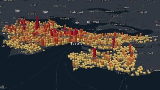
Azure Maps offers you unrivaled worldwide geospatial mapping. See excellent global coverage and seamless integration for our geocoder with a range of platforms. The Azure Maps Geocoding API is key for a range of applications, from mapping to logistics, asset tracking, and optimized service delivery.
Azure Maps Search API
You can combine geocoding with other Search APIs to query the spatial database for addresses, local points of interest and other geographical information to support user services in your application.
Autocomplete
The Geocoding service is very tolerant of incomplete place names and typos. In case of misspellings, the API will give you the best contextual match for your search that you can use to retrieve its coordinates.
Azure Maps Geocoding Service
Leverage an integrated suite of geospatial mapping and analysis services from Azure Maps. These toolsets seamlessly integrate with your applications, enabling you to enhance your solution with robust location data.
Azure Maps APIs
More geospatial functionality

Search
The Azure Maps Search API lets you look up anything from addresses to business listings and other establishments to build rich location-powered experiences for your users.

Geolocation
Azure Maps offers geolocation services that you can use to resolve the IP addresses of any traffic source into geographic locations. You can leverage this to localize the content and services in your applications.

Azure Maps Geocoding APIs
Accurate, quick location information at your fingertips with Azure Maps’ Geocoding service.
Ready to start building?
Azure Maps makes it easy to power your solution with robust geospatial services. Whether you’re an enterprise, a startup, or a developer, getting started with Azure Maps is simple. Benefit from detailed interactive demos and extensive technical documentation to help you in your journey. Count on outstanding 24/7 support all throughout. See Azure Maps Geocoding APIs in action with free transactions.

Get started
Our platform provides you with everything you need — from subscription keys for API authentication to a plethora of code samples, demos and SDKs.

Documentation
Complete with code samples, SDK support, and detailed explanations, this is a one-stop resource for enhancing your projects with the wide range of Azure Maps APIs.

Samples
These pre-written snippets show how to perform various API calls for current weather, forecasts, and severe weather alerts, among other functionalities.
Frequently asked questions
-
Our toolsets rely on a comprehensive database of geospatial data that is continuously updated and improved for accuracy. Built-in search algorithms deliver precise results even for fuzzy and incomplete search strings.
-
Azure Maps offers localization support in dozens of global languages to provide a seamless experience.
-
Yes! If you’re building a solution to validate a physical delivery address, you can use the Geocoding API in concert with the Search API to validate the location against a map. This helps your users identify the correct location by seeing where there is a pin on the map.
-
Yes, it does. You can batch up to 100 queries using a single API call, letting you obtain coordinates for a number of addresses together. The Reverse Geocoding Batch API lets you perform a reverse address search for a batch of coordinates as well.
-
Azure Maps is a pay-as-you-go service. Users are entitled to volume-based discounts. Up to the first 5,000 transactions are free for various services. Please review our pricing plans for more information or simply contact us.
-
Azure Maps is unmatched when it comes to global geospatial mapping and coverage. You can expect a highly reliable service with 24/7 support and versatile toolsets that help you empower your applications with rich location intelligence. Pay only for what you use with Azure Maps with a certain amount of free transactions upfront to help you try out the platform.

Azure Maps
Advanced mapping and visualization features for your applications.
More features from Azure Maps

Data and Insights
Process and analyze massive amounts of real-time and historical location data with Azure Data services to find the best possible solutions to logistics challenges.

Location Services
Map supply chains, locate POIs, and create customized experiences with powerful geolocation data, all backed by robust search APIs and extensive GIS databases.
Mapping and Visualization
Create varied, fully customizable, and interactive graphs that inform creative decision-making. Experience a new way of visualizing your data.