

Search
Perform map searches to find anything, anywhere.
Search for addresses, places, and business listings by name, category, and geographic information.
Powerful. Global. Local.
Azure Maps Search APIs support a wide range of use cases, from simple map displays to complex geospatial data analysis, catering to the needs of various industries such as transportation, logistics, travel, and more.
Search Service
Surface locations, addresses, points of interest (POIs), and other geographical information through Azure Maps API.
Drawing Tools
Draw boundaries or points of interests with icons, polygons, boundary shapes, or custom implementations.
Autosuggest
Autocomplete provides address suggestions as the user types and to pre-populate forms and inputs.
Fuzzy Search
Perform a fuzzy map search for points of interest, address, and places providing local results to the user.
Geocoding and Reverse Geocoding
Geocoding converts addresses into geographic coordinates (latitude and longitude), while reverse geocoding does the opposite, transforming geographic coordinates into human-readable addresses. This is crucial for mapping applications that need to display the exact location of a particular address on a map.
Point of Interest (POI) Search
This feature allows users to search maps for points of interest within a specific area. POIs can include restaurants, parks, shopping centers, and more. Users can search by category, name, or proximity to a location.
Fuzzy Search
The fuzzy search capability helps users find locations or POIs even if the search query is not precisely spelled or phrased correctly. This improves user experience by providing relevant results despite typographical errors or incomplete information.
Batch Geocoding
This allows for the processing of multiple geocoding and reverse geocoding requests in a single batch, making it efficient to handle large volumes of address data.
Route Range
Users can search for points of interest within a reachable range based on a starting point and travel time or distance. This is useful for applications that need to suggest destinations within a certain driving time or distance.
Azure Maps Search Service
The Search service, part of Microsoft’s Azure Maps suite, provides geospatial search capabilities that allow developers to integrate various map-related functions into their applications. This service is designed to help with the discovery of locations, addresses, points of interest (POIs), and other geographical information through a set of APIs.
Azure Maps Location Search APIs
More search functionality

Geocoding
Azure Maps’ geocoding services allow you to look up and convert addresses to longitude/latitude and vice versa. It also allows you to perform map searches for the geographic outline of an area, such as a city or country region.

Geolocation
Azure Maps’ geolocation services allow you to resolve the IP addresses from a range of mobile and fixed internet traffic sources to determine the ISO country code of that IP traffic. This enables the localization of services and content for your application.
Ready to start building?

Get started
Our platform provides you with everything you need — from subscription keys for API authentication to a plethora of code samples, demos and SDKs.

Documentation
Complete with code samples, SDK support, and detailed explanations, this is a one-stop resource for enhancing your projects with the wide range of Azure Maps APIs.

Samples
These pre-written snippets show how to perform various API calls for current weather, forecasts, and severe weather alerts, among other functionalities.
Frequently asked questions
-
The Search API utilizes a comprehensive database of geospatial data, continuously updated and curated for accuracy. It employs advanced map location search algorithms to deliver precise results for addresses, places, businesses, and other points of interest.
-
The Search API is capable of processing queries in more than 45 languages, including regional dialects for major languages such as English, Spanish, and Chinese.
-
While there are no daily limits on searches users can perform using Azure Maps Search API, there are limits on the number of queries per second (QPS). QPS limits vary depending on the selected pricing tier.
-
Yes, Azure Maps can be seamlessly integrated with other Azure tools and services. Customers can implement Azure Maps into their existing Azure subscription or Enterprise agreement.
-
Azure Maps Search Service is ideal for any map location search application in which users need to search for addresses, places, or businesses by name, category, or other criteria. This could include food delivery applications, applications used within the transportation industry, and more.

Azure Maps
Advanced mapping and visualization features for your applications.
More features from Azure Maps

Data and Insights
Process and analyze massive amounts of real-time and historical location data with Azure Data services to find the best possible solutions to logistics challenges.

Indoor Mapping
Build unique and compelling indoor experiences for customers and employees. From tracking indoor assets to navigating venues, indoor mapping has never been easier.

Location Services
Map supply chains, locate POIs, and create customized experiences with powerful geolocation data, all backed by robust search APIs and extensive GIS databases.
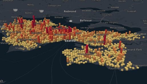
Mapping and Visualization
Create varied, fully customizable, and interactive graphs that inform creative decision-making. Experience a new way of visualizing your data.