

Satellite imagery
Leverage unparalleled geographic insights with satellite imagery
Add detailed high-resolution images of the Earth to your web and mobile applications with Azure Maps’ powerful satellite imagery API.
The globe at your fingertips
Elevate your app’s experience by adding high-quality satellite and aerial photographs as layers in your map to give users more control.
Detailed Views
Access to high-resolution satellite imagery from every corner of the globe. Give users detailed views of the Earth’s surface.
Seamless Integration
Easily integrate satellite imagery into your applications for a vivid, real-world context and engaging user experience.
Real-time Updates
Ensure your applications offer the most current view of the world with satellite imagery that reflects the latest changes.
Scalable Performance
Azure's cloud infrastructure ensures high-performance satellite imagery rendering that is capable of supporting demanding data loads.
Interactive map experiences
Users can easily zoom in to inspect minute details or zoom out for a broader perspective. They can also pan across the map and rotate views to understand geographical layouts better.
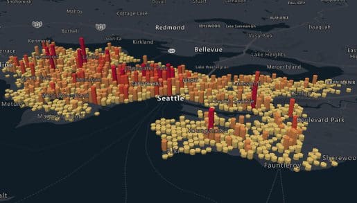
Custom visualization
Azure Maps’ satellite imagery API allows you to overlay custom data, annotate maps with crucial information, and apply filters to emphasize or de-emphasize specific geographic features.
Cross-platform compatibility
Azure satellite imagery provides a consistent and high-quality user experience across all devices, screen sizes, and platforms with smooth performance and responsiveness.
Data-driven decision making
Azure Maps’ comprehensive and detailed overview of geographical areas provides a solid foundation for informed, data-driven decision-making for logistics planning, disaster response, and more.
Azure Maps Satellite Imagery
Azure Maps transcends traditional mapping by offering developers and businesses a dynamic, high-resolution satellite imagery. This service not only enhances the visual appeal of your applications but also serves as a critical tool for analysis and decision-making across the globe.
Azure Maps APIs

Satellite Imagery in Azure Maps
Azure Maps satellite imagery API is your gateway to dynamic map visualization and geographic exploration.
Ready to start building?

Get started
Our platform provides you with everything you need — from subscription keys for API authentication to a plethora of code samples, demos and SDKs.

Documentation
Complete with code samples, SDK support, and detailed explanations, this is a one-stop resource for enhancing your projects with the wide range of Azure Maps APIs.

Samples
These pre-written snippets show how to perform various API calls for current weather, forecasts, and severe weather alerts, among other functionalities.
Frequently asked questions
-
Azure Maps satellite imagery provides high-resolution satellite photos for use in mapping and visualization applications. It enhances apps with real-world context and geographic insights through detailed views of the Earth’s surface.
-
Azure Maps strives to provide the most current satellite imagery available. However, the update frequency can vary by region due to factors such as weather conditions, terrain complexity, and the rate of change in the landscape.
-
While satellite imagery is raster data, Azure Maps allows for the overlay of vector tiles on top of satellite photos. This enables the dynamic display of scalable geographic data such as roads and boundaries and enhances the satellite imagery map’s interactivity and detail. You can learn more about vector files available on Azure Maps (here).
-
Satellite imagery offers limited customization in terms of appearance since it represents real-world photography. However, you can customize the display and interaction with overlaying vector tiles and other map elements to create a tailored user experience.
-
Azure Maps utilizes advanced cloud infrastructure and technologies like WebGL to render satellite imagery efficiently, ensuring high performance and smooth user interactions even when handling large datasets or complex visualizations.

Azure Maps
Advanced mapping and visualization features for your applications.
More features from Azure Maps

Data and Insights
Process and analyze massive amounts of real-time and historical location data with Azure Data services to find the best possible solutions to logistics challenges.

Indoor Mapping
Build unique and compelling indoor experiences for customers and employees. From tracking indoor assets to navigating venues, indoor mapping has never been easier.

Location Services
Map supply chains, locate POIs, and create customized experiences with powerful geolocation data, all backed by robust search APIs and extensive GIS databases.
Mapping and Visualization
Create varied, fully customizable, and interactive graphs that inform creative decision-making. Experience a new way of visualizing your data.