Whether managing a fleet of delivery vehicles, optimizing supply chains, or simply planning your daily commute, factors like weather conditions play a pivotal role in ensuring the safety and timeliness of your journeys.
Azure Maps’ Weather and Route services empower developers and organizations to integrate factors such as weather conditions into route planning and optimization applications. This integration of real-time weather data into Azure route maps makes for safe and efficient transportation.
In this article, we will discuss how Azure Maps’ Weather and Route functionality can assist with route planning in commercial and personal transportation.
Azure Maps Weather Services
To understand how the weather services API in Azure Maps can make route planning safe, we will first briefly discuss each of the relevant features listed as API operations under this service.
Air Quality Forecasts
These API operations will provide users with detailed information about air pollutants, their concentration, and the overall status of the forecasted air quality for different time frames. Users can get access to current, hourly, and daily air forecasts.
Users can, therefore, know the pollution levels, air quality index values, dominant pollutants, risk levels, and suggested precautions while on their journeys.
Current and Daily Conditions
The Current and Daily Conditions API operations will allow Azure route maps users to know detailed weather conditions such as precipitation, temperature and wind for a given coordinate location. Furthermore, with the Azure Maps Weather service, users can also retrieve observations from the past 6 or 24 hours for a particular location using this API operation.
With the daily conditions API operation, users can have a given location’s detailed weather forecasts, such as temperature and wind by day for the next 1, 5, 10, 15, 25, or 45 days.
These API operations will give them a brief description of the weather conditions, weather icons, precipitation indicator flags, and temperature. This can be especially useful for users who need to know the weather conditions at their destination so that they can plan accordingly.
Historical Actual, Normal and Records
Azure Maps Weather’s Historical API operations are also valuable in route planning because they can help users know what to expect from a particular route at a given time.
The Historical Actual API operation, for instance, will provide climatology data as past daily actual observed temperatures, precipitation, snowfall, and cooling/heating degrees for a given coordinate location. Depending on location, this information may be available as far back as the last 5 to 40+ years.
The Historical Normal API operation will essentially do the same thing as the Historical Actual API operation, but the former will provide daily Normal recordings instead of Actual recordings. The same can be said for the Historical Record API, except that this will return the record observations of climatology data during those 5 to 40+ years.
This data can allow users of Azure route maps to prepare better based on expectations from past observations.
The Daily Indices
Azure Maps Weather’s Daily Indices API operation is great for future planning because it can suggest the best weather for various activities from the current day and the next 5, 10, and 15 days. A construction company may, for instance, use this API to plan safe routes for delivery of the needed construction materials. This API is ideal for when users want to know if the weather conditions are optimal for a given activity.
Weather Along Route
The most important API operation for safe route planning is the one that returns hyper-local (one kilometer or less), up-to-minute weather nowcasts, weather hazard assessments, and notifications along a route.
This API returns a list of weather hazards affecting the waypoint or route. Azure Maps Weather service users can determine how safe a portion of a route is by looking at the aggregated hazard index for each waypoint.
Since it provides hyper-local forecasts, it is recommended that users of Azure route maps stay within, or close to, the distance that can be traveled within 120 minutes or shortly after when submitting the waypoints.
This Azure Maps Weather service also supplements the Azure Maps Route Service because it gives users accurate weather information along the requested route from the route service.
Furthermore, this service will be able to provide drivers with notifications in case the vehicle is expected to reach a waypoint with unfavorable weather conditions such as heavy rainfall.
Azure Maps Route Service

Just like the Azure Maps Weather Service API, the Azure Maps Route Service API also contains some useful API operations for safe route planning. These include;
Route Directions
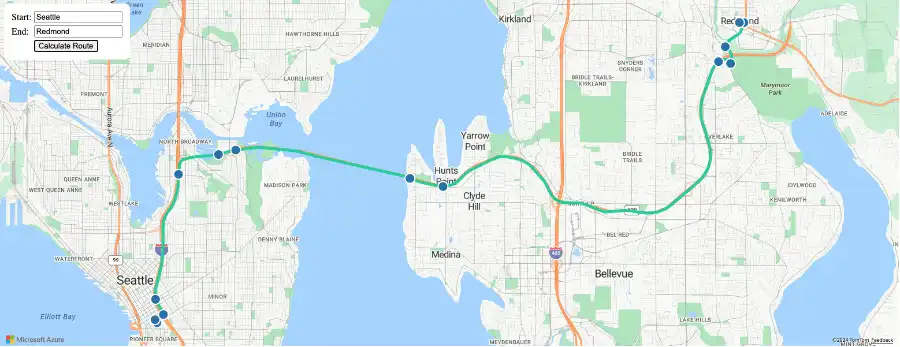
This API operation will return a route between an origin and destination, considering factors such as specified waypoints, current traffic, and typical road speeds on the requested day or time.
The API returns information such as distance and estimated travel time that can allow drivers to plan their routes safely.
Route Range
Another useful API operation in the Azure Maps Route Service is the route range (Isochrone) API, which will calculate a set of locations that can be reached from the origin point based on factors such as fuel, time, and distance.
Safe Route Planning Best Practices with Azure Maps Weather and Route Services
When using the route service in your Azure route maps:
- Ensure that you accurately define your start and end points, and in case of complex routes, specify multiple waypoints.
- Select the transportation mode, especially for heavy or tall vehicles that may have route restrictions.
- Ensure that you utilize the Azure Maps Routes API to request route calculations and once an optimal route is suggested, do not ignore the notifications at the various waypoints.
For the Weather Service:
- Continuously fetch data to monitor changing weather conditions and adapt to evolving situations.
- If the weather conditions deteriorate, re-optimize your route using Azure Maps’ route recalculation feature and avoid hazards.
Finally, safe route planning doesn’t end when the journey begins. Continuously monitoring your route conditions is essential for ensuring safe and efficient travel. Start building for free with the Azure Maps Weather and Route Services APIs.